GIS

GEOSPATIAL  / GIS

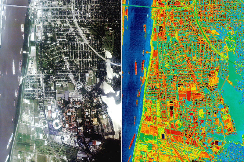
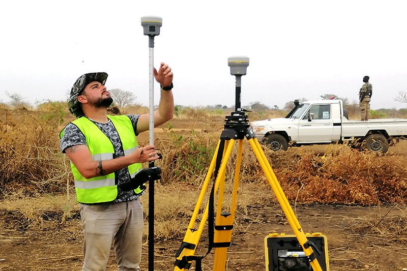
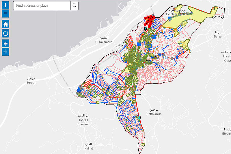
The Earth is always changing. Knowing how affords your company a strategic advantage. We use many data sources (including satellites, drones, maps, field surveys) to assemble data. We then build live geospatial analytic products. These deliver insights into the world that surrounds your business. Our clients appreciate how we make this complex information consumable and applicable.

GeoSpatialMinds is a one stop/shop company where you can acquire a very wide variety of GIS and Geospatial services and solutions.

Remote Sensing

REMOTE  SENSING

GeoSpatialMinds remote sensing imagery services range from satellite image procurement from worldwide imagery providers and Aerial Imagery acquisition using GeoSpatialMinds Drone Fleet along with image processing, interpretation and image analysis for various applications.

Our remote sensing services are used for macro level applications such as land use planning, natural resource management, watershed management, wasteland mapping, corridor mapping for industrial zone, dam site identifications and livelihood development. Our services include:

• Seamless Raster Data Products
• Terrain Mapping & Digital Elevation Modeling
• Land use/ Land cover (LULC) Classification
• Change Detection Mapping & Analysis
• Advance Spatial Analysis

Surveying

SURVEYING

GeoSpatialMinds provides complete land survey services across the area of operations to support our clients’ needs. From energy to transportation, we offer surveying services to all markets.

Our team has expertise in boundary and cadastral surveys, route and alignment surveys, topographic surveys and GNSS control network surveys.

GeoSpatialMinds performs survey for high precision deformation, utility location, hydrography, drainage and fully supports the survey needs of the construction industry.

Photogrammetry

PHOTOGRAMMETRY

GeoSpatialMinds provides photogrammetry services for more accurate needs such as 3D building high resolution databases Generated and produced using high resolution stereo pair aerial photographs or satellite imagery or any alternative source available. The range of products offered by our photogarammetric team are as follows:

   • Aerial Triangulation
   • Orthophoto Generation
   • True Orthophoto Generation
   • 3D City Models
   • Digital Terrain Modeling and 3D Visualization
   • DEM and Contour lines
   • Building Height Model (BHM)
   • Land Use data (Clutter data)
   • 3D Geo databases – 3D Features Extraction

Applications

APPLICATIONS

GeoSpatialMinds offers Geographical Information Systems (GIS) as well Solutions, ranging from various data collection, data analysis, system implementation and integration, project management and implementation, core GIS and custom made training on top of Esri and other software providers. GeoSpatialMinds is proud to be Esri Silver partner since 2014.

Training

TRAINING / INTERNSHIP

GeoSpatialMinds Regional Training Centers offers a range of GeoSpatial training courses to meet the needs of GIS users and those who wish to fully utilize the capabilities of a GIS technology in Lebanon, UAE and South Sudan. Our customers can choose to receive their training in any of these 3 countries.

Our dedicated training staff provides our trainees with long term support to answer all their inquiries on their GIS problems to ensure practical applications of what has been taught and learned inside the classroom.

Technical Support

TECHNICAL  SUPPORT

GeoSpatialMinds provides a special approach in technical support and customer service based on the wide range of solutions that we deliver.

As we are not limited to one service or solution, we provide technical support and on the job assistance on:

   • Esri software technology
   • Open Source GeoSpatial Solutions
   • Hardware maintenance and technical support
     (GPS , Total Station , Laser Scanners )
   • Drones maintenance and technical support
     (Sensefly, DJI)

GeoSpatialMinds technical and customer service department can be contacted via e-mail, phone, fax or web site on Mondays to Fridays between 8:00 am and 6:00 pm.

GeoSpatialMinds SAL

Antelias, DEMCO Center
18th Floor
Beirut, Lebanon
P: +961 3 843 549

GSM Ltd - South Sudan

Tulip Inn Hotel, Airport Road, Office #3
Juba, South Sudan
M: +211 911 100 500 (WhatsApp if no signal)

  GeoSpatialMinds FZ LLC 

   JLT, Saba Towers
   Dubai, United Arab Emirates
   M: +971 52 101 2727